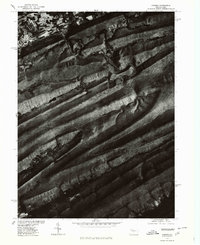
1977 Map of Coburn
USGS Topo · Published 1979About this map
Penns Creek meanders through the sharp, linear ridges of central Pennsylvania, cutting a deep valley between Long Mountain and Front Mtn. This 1977 orthophotoquad captures the physical landscape during a transition in mapping technology, utilizing high-altitude aerial photography rectified to a topographic grid. The imagery reveals the stark contrast between the heavy timber of the ridges and the precisely patterned agricultural fields in the valleys. This visual record of the land use patterns and topographical barriers in Centre County provides a clear view of the natural corridors that have historically dictated movement and settlement in this portion of the Appalachian Mountains.
Find a feature on this map
3 named features on this map. Tap any name to fly to it.
Don’t see what you’re looking for? This feature index may not catch every label — zoom into the map to look around manually.
Map Details
Editions of this 1977 Coburn Map
This is the sole edition of this map. No revisions or reprints were ever made.
Other maps of this area

1924 · Centre Hall
USGS Topo · 1:62,500

1924 · Lewistown
USGS Topo · 1:62,500

1925 · Mifflintown
USGS Topo · 1:48,000

1927 · Lewisburg
USGS Topo · 1:62,500

1929 · Centre Hall
USGS Topo · 1:62,500

1934 · Mifflintown
USGS Topo · 1:62,500

1937 · Mifflintown
USGS Topo · 1:62,500

1937 · Millheim
USGS Topo · 1:48,000

1941 · Millheim
USGS Topo · 1:62,500

1943 · Lewistown
USGS Topo · 1:125,000