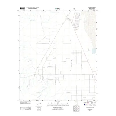
2012 Map of Cochise
USGS Topo · Published 2012About this map
Cochise anchors the northeastern corner of this high-desert landscape, where the northern tip of the Willcox Playa meets a grid of rural ranch roads. The settlement is centered around a local Po and a small network of residential streets named for western states and regions, while the broader terrain is defined by dry drainage features like Walnut Wash and the Big Draw. To the southwest, the small settlement of Manzoro sits near the crossing of N Manzora Rd and W Big Draw Rd, reflecting a sparse ranching-based infrastructure. Researchers will find interest in the naming of rural routes such as Butterfield Ln and W Spear Ranch Rd, which suggest historic property boundaries and travel corridors. Small-scale aviation is represented by the Ammon Airport, situated south of the major east-west artery of W Dragoon Rd.
Find a feature on this map
72 named features on this map. Tap any name to fly to it.
Don’t see what you’re looking for? This feature index may not catch every label — zoom into the map to look around manually.
Map Details
Editions of this 2012 Cochise Map
This is the sole edition of this map. No revisions or reprints were ever made.
Other maps of this area

1915 · Benson
USGS Topo · 1:125,000

1916 · Pearce
USGS Topo · 1:125,000

1922 · Willcox
USGS Topo · 1:125,000

1922 · St. David
USGS Topo · 1:62,500

1926 · Courtland
USGS Topo · 1:62,500

1943 · Benson
USGS Topo · 1:125,000

1943 · Cochise
USGS Topo · 1:62,500

1943 · Dragoon
USGS Topo · 1:62,500

1954 · Silver City
USGS Topo · 1:250,000

1955 · Douglas
USGS Topo · 1:250,000