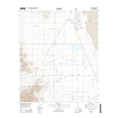
2014 Map of Cochise
USGS Topo · Published 2014About this map
The settlement of Cochise anchors the northeastern portion of this High Desert landscape, situated where the arid plains meet the edge of the Willcox Playa. The map reveals a distinct grid of residential streets with names like W Calle Texas and W Calle Oklahoma, contrasting with the more organic, rugged topography of the Gunnison Hills and the Dragoon Mountains to the southwest. In the southern reaches, the Coronado National Forest boundary protects the terrain rising toward Dragoon Peak.
Find a feature on this map
71 named features on this map. Tap any name to fly to it.
Don’t see what you’re looking for? This feature index may not catch every label — zoom into the map to look around manually.
Map Details
Editions of this 2014 Cochise Map
This is the sole edition of this map. No revisions or reprints were ever made.
Other maps of this area

1915 · Benson
USGS Topo · 1:125,000

1916 · Pearce
USGS Topo · 1:125,000

1922 · Willcox
USGS Topo · 1:125,000

1922 · St. David
USGS Topo · 1:62,500

1926 · Courtland
USGS Topo · 1:62,500

1943 · Benson
USGS Topo · 1:125,000

1943 · Cochise
USGS Topo · 1:62,500

1943 · Dragoon
USGS Topo · 1:62,500

1954 · Silver City
USGS Topo · 1:250,000

1955 · Douglas
USGS Topo · 1:250,000