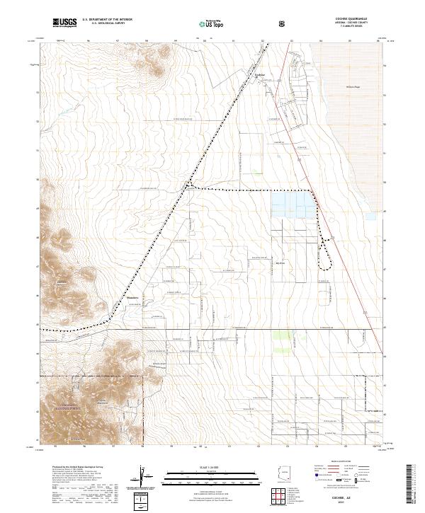
2021 Map of Cochise
USGS Topo · Published 2021About this map
The high desert landscape of Cochise County is defined by the transition from the arid floor of the Willcox Playa to the prominent heights of the Dragoon Mountains. The small community of Cochise sits at a critical junction where the Union Pacific Railroad intersects local travel routes like Cemetery Dr, serving as a gateway to the historic cattle ranching and mining lands of the Southwest. To the southwest, the Gunnison Hills and Dragoon Peak rise sharply, with a portion of the territory protected as part of the Coronado National Forest.
Find a feature on this map
81 named features on this map. Tap any name to fly to it.
Don’t see what you’re looking for? This feature index may not catch every label — zoom into the map to look around manually.
Map Details
Editions of this 2021 Cochise Map
This is the sole edition of this map. No revisions or reprints were ever made.
Other maps of this area

1915 · Benson
USGS Topo · 1:125,000

1916 · Pearce
USGS Topo · 1:125,000

1922 · Willcox
USGS Topo · 1:125,000

1922 · St. David
USGS Topo · 1:62,500

1926 · Courtland
USGS Topo · 1:62,500

1943 · Benson
USGS Topo · 1:125,000

1943 · Cochise
USGS Topo · 1:62,500

1943 · Dragoon
USGS Topo · 1:62,500

1954 · Silver City
USGS Topo · 1:250,000

1955 · Douglas
USGS Topo · 1:250,000