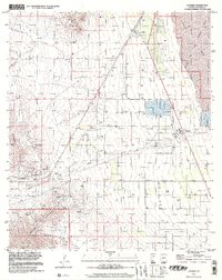
1996 Map of Cochise
USGS Topo · Published 2002About this map
Cochise serves as a central hub in this high-desert landscape, where industrial and military operations meet the foothills of the Dragoon Mountains. To the east, the expansive Willcox Playa and Dry Lake are partially occupied by the Willcox Bombing Range, illustrating the strategic use of these vast alkaline flats during the late 20th century. Industrial infrastructure is prominent near the settlement, including a Power Plant, Cooling Towers, and a complex system of Conveyors and Pipelines.
Find a feature on this map
25 named features on this map. Tap any name to fly to it.
Don’t see what you’re looking for? This feature index may not catch every label — zoom into the map to look around manually.
Map Details
Editions of this 1996 Cochise Map
This is the sole edition of this map. No revisions or reprints were ever made.
Other maps of this area

1915 · Benson
USGS Topo · 1:125,000

1916 · Pearce
USGS Topo · 1:125,000

1922 · Willcox
USGS Topo · 1:125,000

1922 · St. David
USGS Topo · 1:62,500

1926 · Courtland
USGS Topo · 1:62,500

1943 · Benson
USGS Topo · 1:125,000

1943 · Cochise
USGS Topo · 1:62,500

1943 · Dragoon
USGS Topo · 1:62,500

1954 · Silver City
USGS Topo · 1:250,000

1955 · Douglas
USGS Topo · 1:250,000