
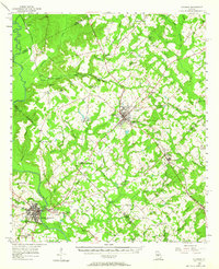
1956 Map of Cochran
USGS Topo · Published 1957About this map
Middle Georgia College sits at the heart of the city of Cochran, serving as a central hub for this portion of Bleckley County during the mid-1950s. The Southern railroad line anchors the local economy, connecting several timber and agricultural settlements such as Empire, Roddy, and Gresston. To the southwest, the Ocmulgee River creates a natural boundary, with the historic community of Hartford and the city of Hawkinsville positioned along its eastern and western banks.
Find a feature on this map
69 named features on this map. Tap any name to fly to it.
Don’t see what you’re looking for? This feature index may not catch every label — zoom into the map to look around manually.
Map Details
Editions of this 1956 Cochran Map
2 editions found
Other maps of this area

1956 · Perry
USGS Topo · 1:62,500

1956 · Warner Robins
USGS Topo · 1:62,500

1956 · Jeffersonville
USGS Topo · 1:62,500

1957 · Macon
USGS Topo · 1:250,000

1958 · Macon
USGS Topo · 1:250,000

1964 · Macon
USGS Topo · 1:250,000

1972 · Eastman
USGS Topo · 1:24,000

1972 · Finleyson East
USGS Topo · 1:24,000

1972 · West Of Eastman
USGS Topo · 1:24,000

1972 · Finleyson West
USGS Topo · 1:24,000