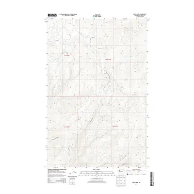
2014 Map of Cody Lake
USGS Topo · Published 2014About this map
Colville Indian Reservation lands dominate this high-elevation landscape in eastern Washington, where the terrain is defined by a dense network of mountain drainages. The namesake Cody Lake sits in the northwest quadrant, surrounded by several prominent creeks including Twentymile Cr and Thirtymile Cr. This 2014 survey reveals a transition from remote waterway systems to modernized infrastructure within the reservation boundaries. A complex system of Bureau of Indian Affairs routes, such as Bia 99 RD and Bia 73 RD, provides access across the ridgelines, while the Twin Lakes Summit Trl and Keno Trail Rd offer insight into historical and recreational movement through the forest. The presence of Bridge Cr and Lynx Cr underscores the area's role as a vital watershed for the region.
Find a feature on this map
20 named features on this map. Tap any name to fly to it.
Don’t see what you’re looking for? This feature index may not catch every label — zoom into the map to look around manually.
Map Details
Editions of this 2014 Cody Lake Map
This is the sole edition of this map. No revisions or reprints were ever made.
Other maps of this area

1948 · Wilmont Creek
USGS Topo · 1:62,500

1950 · Wilmont Creek
USGS Topo · 1:62,500

1952 · Keller
USGS Topo · 1:62,500

1952 · Twin Lakes
USGS Topo · 1:62,500

1953 · Seventeenmile Mtn.
USGS Topo · 1:62,500

1954 · Okanogan
USGS Topo · 1:250,000

1956 · Wilmont Creek
USGS Topo · 1:62,500

1958 · Okanogan
USGS Topo · 1:250,000

1984 · Nespelem
USGS Topo · 1:100,000
1985 · Sitdown Mtn
USGS Topo · 1:24,000