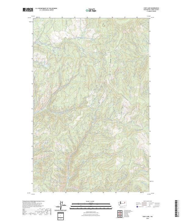
2023 Map of Cody Lake
USGS Topo · Published 2023About this map
Cody Lake sits within a high-elevation drainage system in Ferry County, where a network of forest roads and pack trails provides the primary access to this remote interior landscape. The drainage patterns are defined by several long-reach waterways, including Twentythree Mile Creek to the north and the expansive basin of Bridge Creek that dominates the central terrain. Land management boundaries are clearly marked by Bureau of Indian Affairs routes such as Bia RD 98, alongside utilitarian names that suggest historical land use like Sitdown Creek Rd. High-ridgeline traversal is documented through the Twin Lakes-Summit Trl and Oregon City Ridge Rd, indicating a terrain where transportation is dictated by the steep contours and significant elevations between Lynx Creek and the southern Wilmont Creek.
Find a feature on this map
24 named features on this map. Tap any name to fly to it.
Don’t see what you’re looking for? This feature index may not catch every label — zoom into the map to look around manually.
Map Details
Editions of this 2023 Cody Lake Map
This is the sole edition of this map. No revisions or reprints were ever made.
Other maps of this area

1948 · Wilmont Creek
USGS Topo · 1:62,500

1950 · Wilmont Creek
USGS Topo · 1:62,500

1952 · Keller
USGS Topo · 1:62,500

1952 · Twin Lakes
USGS Topo · 1:62,500

1953 · Seventeenmile Mtn.
USGS Topo · 1:62,500

1954 · Okanogan
USGS Topo · 1:250,000

1956 · Wilmont Creek
USGS Topo · 1:62,500

1958 · Okanogan
USGS Topo · 1:250,000

1984 · Nespelem
USGS Topo · 1:100,000
1985 · Sitdown Mtn
USGS Topo · 1:24,000