1972 Map of Codys Corner
USGS Topo · Published 1973About this map
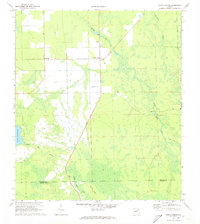
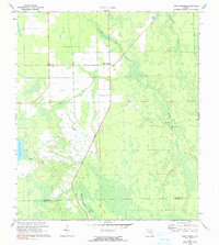
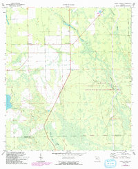
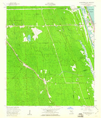
Codys Corner serves as the focal point of this interior Florida landscape, situated at a road junction amidst a network of drainage features and wetlands. The map illustrates a transitional environment where agricultural and forestry interests meet the natural hydrology of the region, including the headwaters of Middle Haw Creek and Little Haw Creek. Evidence of early settlement and rural industry is visible at Deanville and Relay, the latter marked by a Lookout Tower presumably for fire surveillance. The terrain is dominated by the sprawling Heart Island and the eastern edge of Lake Disston, reflecting the low-lying character of the border between Flagler and Volusia counties. Man-made interventions like the Parker Canal and various Jeep Trails snake through the marshy sections, showing how local residents and state agencies navigated and managed the Florida interior during the early 1970s.
Find a feature on this map
13 named features on this map. Tap any name to fly to it.
Don’t see what you’re looking for? This feature index may not catch every label — zoom into the map to look around manually.
Map Details
Editions of this 1972 Codys Corner Map
3 editions found
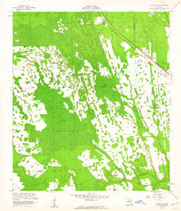
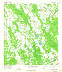
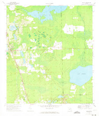
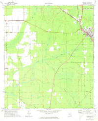
Other maps of this area

1937 · Ormond
USGS Topo · 1:48,000

1944 · Ormond
USGS Topo · 1:62,500

1954 · Daytona Beach
USGS Topo · 1:250,000
1956 · Favoretta
USGS Topo · 1:24,000
1956 · Flagler Beach West
USGS Topo · 1:24,000

1958 · Daytona Beach
USGS Topo · 1:250,000
1962 · Daytona Beach NW
USGS Topo · 1:24,000

1964 · Daytona Beach
USGS Topo · 1:250,000
1970 · Seville
USGS Topo · 1:24,000
1970 · Bunnell
USGS Topo · 1:24,000