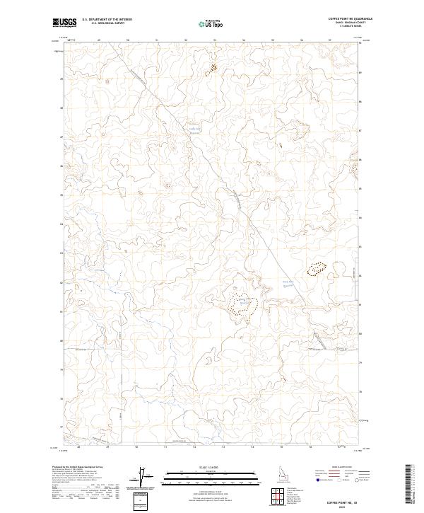
2023 Map of Coffee Point NE
USGS Topo · Published 2023About this map
Water management and agricultural transit define this pocket of the Snake River Plain in Bingham County. The landscape is characterized by its reliance on catchment systems, including Duck Lake Reservoir, Sheep Lake Reservoir, and Camp Four Reservoir. These features suggest a terrain where irrigation and livestock water sources are paramount for sustaining land use.
Find a feature on this map
14 named features on this map. Tap any name to fly to it.
Don’t see what you’re looking for? This feature index may not catch every label — zoom into the map to look around manually.
Map Details
Editions of this 2023 Coffee Point NE Map
This is the sole edition of this map. No revisions or reprints were ever made.
Other maps of this area

1955 · Springfield NW
USGS Topo · 1:24,000

1955 · Springfield
USGS Topo · 1:24,000

1955 · Idaho Falls
USGS Topo · 1:250,000

1958 · Idaho Falls
USGS Topo · 1:250,000

1973 · Taber
USGS Topo · 1:24,000

1973 · Rock Butte
USGS Topo · 1:24,000
1973 · Coffee Point SW
USGS Topo · 1:24,000

1973 · Lava Lake Reservoir
USGS Topo · 1:24,000

1973 · Coffee Point NE
USGS Topo · 1:24,000
1973 · Coffee Point
USGS Topo · 1:24,000