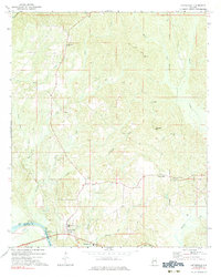
1971 Map of Coffeeville
USGS Topo · Published 1983About this map
Tombigbee River forms a critical geography here along the Clarke and Choctaw County boundary, anchoring a landscape defined by its creek networks and rural congregations. The settlement of Coffeeville serves as a local hub, featuring a High School and the Coffeeville Church near the riverbanks. Riverside activity is evidenced by Nichols Landing and Coffeeville Landing, points of transition between waterborne transport and the interior uplands.
Find a feature on this map
34 named features on this map. Tap any name to fly to it.
Don’t see what you’re looking for? This feature index may not catch every label — zoom into the map to look around manually.
Map Details
Editions of this 1971 Coffeeville Map
This is the sole edition of this map. No revisions or reprints were ever made.
Other maps of this area

1953 · West Point
USGS Topo · 1:250,000

1954 · Grenada
USGS Topo · 1:62,500

1954 · Oakland
USGS Topo · 1:62,500

1954 · Water Valley
USGS Topo · 1:62,500

1955 · Water Valley
USGS Topo · 1:62,500

1955 · Coffeeville
USGS Topo · 1:62,500

1956 · Tupelo
USGS Topo · 1:250,000

1958 · Tupelo
USGS Topo · 1:250,000

1958 · West Point
USGS Topo · 1:250,000

1963 · West Point
USGS Topo · 1:250,000