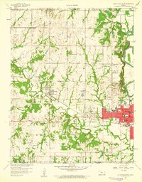
1959 Map of Coffeyville West
USGS Topo · Published 1960About this map
Coffeyville expands westward in the late 1950s, bounded by the Verdigris River and a landscape defined by the historic Indian Boundary. The industrial and transportation identity of the region is evident in the Missouri Pacific railroad lines that intersect at Dearing, serving the numerous Oil Wells scattered across the northern sections. This era shows a community transition, where traditional rural life and modern development meet.
Find a feature on this map
45 named features on this map. Tap any name to fly to it.
Don’t see what you’re looking for? This feature index may not catch every label — zoom into the map to look around manually.
Map Details
Editions of this 1959 Coffeyville West Map
2 editions found
Other maps of this area

1886 · Independence
USGS Topo · 1:125,000

1894 · Independence
USGS Topo · 1:125,000

1901 · Nowata
USGS Topo · 1:125,000

1905 · Independence
USGS Topo · 1:125,000

1914 · Nowata
USGS Topo · 1:125,000

1947 · Joplin
USGS Topo · 1:250,000

1949 · Joplin
USGS Topo · 1:250,000

1954 · Tulsa
USGS Topo · 1:250,000

1954 · Joplin
USGS Topo · 1:250,000

1958 · Joplin
USGS Topo · 1:250,000