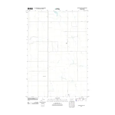
2011 Map of Coffin Buttes
USGS Topo · Published 2011About this map
Selma Union Cemetery sits in the southeastern corner of this Grant County landscape, providing a primary point of interest for genealogical research in this sparsely populated stretch of North Dakota. The terrain is characterized by its creek systems and distinct topographic rises, most notably the eponymous Coffin Buttes and the high point at Jacks Lookout. Water resources are concentrated around Pretty Rock Lake in the north and the drainages of Sheep Creek, Brushy Creek, and Alkali Creek. The map details a strictly rectilinear grid of section-line roads, such as 78th Ave SW and 85th St SW, which define the agricultural layout of the region. This 2011 survey captures the enduring rural character of the Great Plains, where land use is dictated by the subtle drainage patterns of the prairie.
Find a feature on this map
18 named features on this map. Tap any name to fly to it.
Don’t see what you’re looking for? This feature index may not catch every label — zoom into the map to look around manually.
Map Details
Editions of this 2011 Coffin Buttes Map
This is the sole edition of this map. No revisions or reprints were ever made.
Other maps of this area

1953 · Dickinson
USGS Topo · 1:250,000

1954 · Bismarck
USGS Topo · 1:250,000

1957 · Dickinson
USGS Topo · 1:250,000

1958 · Bismarck
USGS Topo · 1:250,000

1969 · Bentley
USGS Topo · 1:24,000

1972 · Coffin Buttes
USGS Topo · 1:24,000

1972 · New Leipzig South
USGS Topo · 1:24,000

1972 · Pretty Rock Butte
USGS Topo · 1:24,000

1972 · Sheep Creek Dam
USGS Topo · 1:24,000

1972 · Pretty Rock Butte SE
USGS Topo · 1:24,000