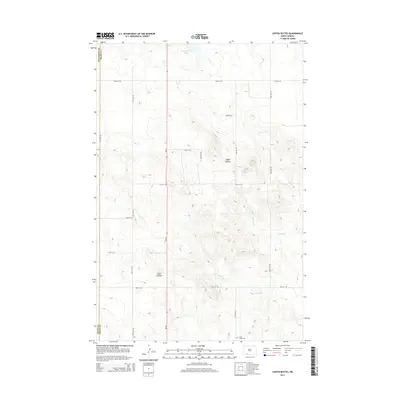
2014 Map of Coffin Buttes
USGS Topo · Published 2014About this map
Coffin Buttes and Jacks Lookout dominate this prairie landscape in southern Grant County, where the terrain is defined by dramatic elevation changes between high plateaus and creek beds. In the southern portion of the map, Selma Union Cem remains as a focal point for local genealogy, situated along the section lines near 88th St SW. The area's drainage is directed through Alkali Cr and Brushy Cr, which cut through the undulating plains. Transport follows a rigid section-line grid, bisected by the north-south corridor of ND-49. In the north, Pretty Rock Lake provides a rare perennial water feature in this semi-arid environment, serving as a landmark near the Hettinger County line. This survey provides a clear view of the intersection of rural infrastructure and the land's natural contours during the early 21st century.
Find a feature on this map
22 named features on this map. Tap any name to fly to it.
Don’t see what you’re looking for? This feature index may not catch every label — zoom into the map to look around manually.
Map Details
Editions of this 2014 Coffin Buttes Map
This is the sole edition of this map. No revisions or reprints were ever made.
Other maps of this area

1953 · Dickinson
USGS Topo · 1:250,000

1954 · Bismarck
USGS Topo · 1:250,000

1957 · Dickinson
USGS Topo · 1:250,000

1958 · Bismarck
USGS Topo · 1:250,000

1969 · Bentley
USGS Topo · 1:24,000

1972 · Coffin Buttes
USGS Topo · 1:24,000

1972 · New Leipzig South
USGS Topo · 1:24,000

1972 · Pretty Rock Butte
USGS Topo · 1:24,000

1972 · Sheep Creek Dam
USGS Topo · 1:24,000

1972 · Pretty Rock Butte SE
USGS Topo · 1:24,000