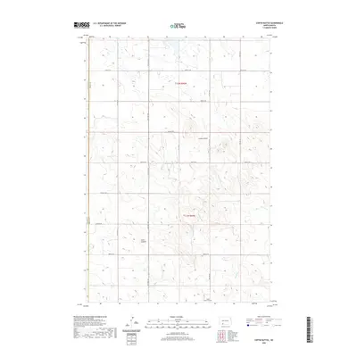
2020 Map of Coffin Buttes
USGS Topo · Published 2020About this map
The northern plains of Grant County are defined by a sparse, high-prairie landscape where drainage patterns and localized water sources dictated the rhythm of rural life. Pretty Rock Lake serves as a primary geographic anchor in this section of the state, surrounded by the township and range grids of the Public Land Survey System. The terrain is characterized by a series of buttes and low-lying basins that reflect the post-glacial geology of the region. This survey, conducted by the U.S. Geological Survey using data from the National Hydrography Dataset and National Elevation Dataset, provides a clear record of the section lines and rural road networks that have remained largely unchanged for generations. The isolation of these water bodies and landforms highlights the endurance of the agricultural infrastructure in this part of North Dakota.
Find a feature on this map
1 named feature on this map. Tap any name to fly to it.
Don’t see what you’re looking for? This feature index may not catch every label — zoom into the map to look around manually.
Map Details
Editions of this 2020 Coffin Buttes Map
This is the sole edition of this map. No revisions or reprints were ever made.
Other maps of this area

1953 · Dickinson
USGS Topo · 1:250,000

1954 · Bismarck
USGS Topo · 1:250,000

1957 · Dickinson
USGS Topo · 1:250,000

1958 · Bismarck
USGS Topo · 1:250,000

1969 · Bentley
USGS Topo · 1:24,000

1972 · Coffin Buttes
USGS Topo · 1:24,000

1972 · New Leipzig South
USGS Topo · 1:24,000

1972 · Pretty Rock Butte
USGS Topo · 1:24,000

1972 · Sheep Creek Dam
USGS Topo · 1:24,000

1972 · Pretty Rock Butte SE
USGS Topo · 1:24,000