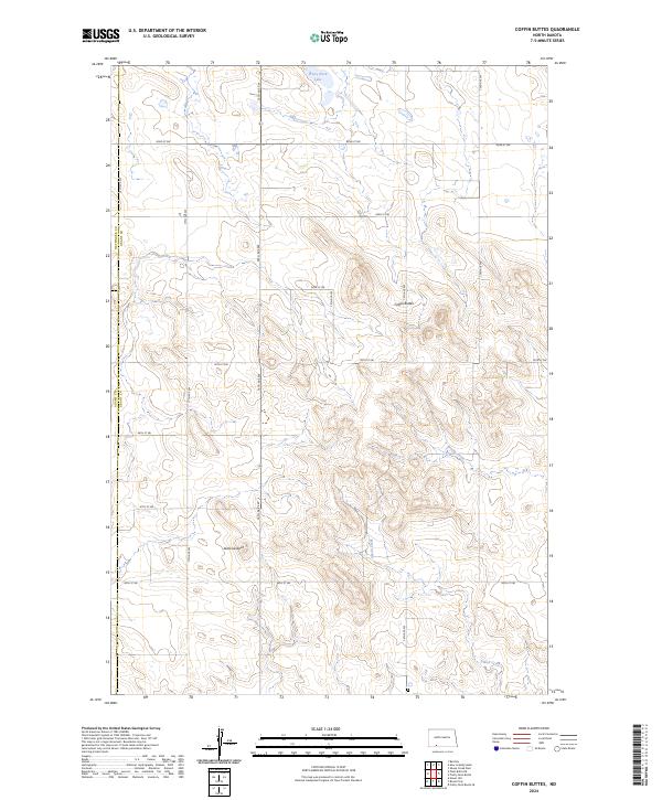
2024 Map of Coffin Buttes
USGS Topo · Published 2024About this map
Coffin Buttes and the prominence of Jacks Lookout dominate this prairie landscape where Grant, Adams, and Hettinger counties meet. The terrain is defined by these high points and the intermittent drainage systems of Brushy Creek and Alkali Creek, which carve through the plains. A strictly organized grid of section-line roads, including 85th St SW and 82nd St SW, illustrates the enduring influence of the Public Land Survey System on North Dakota's rural geography. To the north, Pretty Rock Lake provides a rare permanent water feature in an area otherwise characterized by high-elevation buttes and seasonal draws. This map captures the vast, open character of the region as it remains today, highlighting the topographic features that have served as landmarks for generations of ranchers and land managers.
Find a feature on this map
16 named features on this map. Tap any name to fly to it.
Don’t see what you’re looking for? This feature index may not catch every label — zoom into the map to look around manually.
Map Details
Editions of this 2024 Coffin Buttes Map
This is the sole edition of this map. No revisions or reprints were ever made.
Other maps of this area

1953 · Dickinson
USGS Topo · 1:250,000

1954 · Bismarck
USGS Topo · 1:250,000

1957 · Dickinson
USGS Topo · 1:250,000

1958 · Bismarck
USGS Topo · 1:250,000

1969 · Bentley
USGS Topo · 1:24,000

1972 · Coffin Buttes
USGS Topo · 1:24,000

1972 · New Leipzig South
USGS Topo · 1:24,000

1972 · Pretty Rock Butte
USGS Topo · 1:24,000

1972 · Sheep Creek Dam
USGS Topo · 1:24,000

1972 · Pretty Rock Butte SE
USGS Topo · 1:24,000