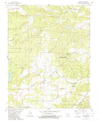
1980 Map of Coffman
USGS Topo · Published 1980About this map
The community of Coffman serves as a central hub in this Missouri landscape, surrounded by the headwaters of River Aux Vases and Saline Creek. This rural terrain is defined by a dense concentration of early family landmarks and civic structures, including the Stone Church and nearby Stone Church Cemetery. Local history is deeply etched into the topography through features like Jackson Cemetery and Mayberry Cemetery, alongside remnants of local education at the Coffman School.
Find a feature on this map
51 named features on this map. Tap any name to fly to it.
Don’t see what you’re looking for? This feature index may not catch every label — zoom into the map to look around manually.
Map Details
Editions of this 1980 Coffman Map
This is the sole edition of this map. No revisions or reprints were ever made.
Other maps of this area

1904 · Farmington
USGS Topo · 1:62,500

1906 · Farmington
USGS Topo · 1:62,500

1907 · Weingarten
USGS Topo · 1:62,500

1909 · Weingarten
USGS Topo · 1:62,500

1910 · Higdon
USGS Topo · 1:62,500

1939 · Fredericktown
USGS Topo · 1:48,000

1947 · Fredericktown
USGS Topo · 1:62,500

1949 · Rolla
USGS Topo · 1:250,000

1950 · Fredericktown
USGS Topo · 1:62,500

1953 · Rolla
USGS Topo · 1:250,000