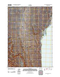
2011 Map of Coglan Buttes NE
USGS Topo · Published 2011About this map
Lake Abert dominates the eastern landscape of this portion of Lake County, appearing as a significant salt lake along the High Desert edge. The water body is defined by a distinct shoreline where the desert floor meets the basin, a characteristic feature of the Oregon Outback. The 2011 documentation by the U.S. Geological Survey shows a sparse network of roads and ephemeral watercourses feeding into the lake's western side. This survey captures the hydrologic state of the basin in the early 21st century, illustrating how the natural drainage patterns interact with the high-elevation basin floor.
Find a feature on this map
1 named feature on this map. Tap any name to fly to it.
Don’t see what you’re looking for? This feature index may not catch every label — zoom into the map to look around manually.
Map Details
Editions of this 2011 Coglan Buttes NE Map
This is the sole edition of this map. No revisions or reprints were ever made.
Other maps of this area

1955 · Klamath Falls
USGS Topo · 1:250,000

1958 · Klamath Falls
USGS Topo · 1:250,000

1966 · Coglan Buttes NE
USGS Topo · 1:24,000

1966 · Tucker Hill
USGS Topo · 1:24,000

1966 · Coglan Buttes SE
USGS Topo · 1:24,000

1966 · Coglan Buttes
USGS Topo · 1:24,000

1968 · Lake Abert North
USGS Topo · 1:24,000

1968 · Lake Abert South
USGS Topo · 1:24,000

1974 · Lake Abert
USGS Topo · 1:100,000
1984 · Sawed Horn
USGS Topo · 1:24,000