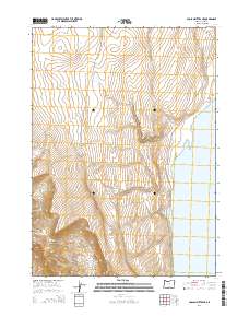
2014 Map of Coglan Buttes NE
USGS Topo · Published 2014About this map
Lake Abert dominates the eastern landscape of this High Desert quadrangle, where the steep escarpment drops toward the alkaline shoreline. The terrain to the west is defined by the prominent heights of Coglan Butte and the deep incision of Coglan Canyon. This area reflects the characteristic basin and range geography of Lake County, with land divided into expansive drainage areas like Big Basin and scars from the Abert Burn. Local history is anchored by the presence of private landholdings and travel ways such as Clark Rnch and Hotchkiss, which trace the base of the ridges. The survey illustrates the intersection of vast public lands and the historical ranching activity that has long shaped the Oregon interior.
Find a feature on this map
13 named features on this map. Tap any name to fly to it.
Don’t see what you’re looking for? This feature index may not catch every label — zoom into the map to look around manually.
Map Details
Editions of this 2014 Coglan Buttes NE Map
This is the sole edition of this map. No revisions or reprints were ever made.
Other maps of this area

1955 · Klamath Falls
USGS Topo · 1:250,000

1958 · Klamath Falls
USGS Topo · 1:250,000

1966 · Coglan Buttes NE
USGS Topo · 1:24,000

1966 · Tucker Hill
USGS Topo · 1:24,000

1966 · Coglan Buttes SE
USGS Topo · 1:24,000

1966 · Coglan Buttes
USGS Topo · 1:24,000

1968 · Lake Abert North
USGS Topo · 1:24,000

1968 · Lake Abert South
USGS Topo · 1:24,000

1974 · Lake Abert
USGS Topo · 1:100,000
1984 · Sawed Horn
USGS Topo · 1:24,000