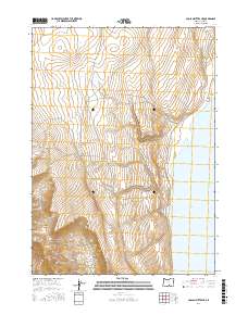
2017 Map of Coglan Buttes NE
USGS Topo · Published 2017About this map
Lake Abert dominates the eastern landscape of this high desert region, its alkaline waters meeting a steep, rising escarpment. To the west, the rugged topography is defined by the deep incision of Coglan Canyon, which cuts through the volcanic geology of the northern Great Basin. The map details a transition from the stark shoreline of Oregon’s largest hypersaline lake to the higher elevations of the surrounding buttes. Surveyed by the U.S. Geological Survey, this sheet documents a largely uninhabited wilderness, focusing on the distinct landforms and drainage patterns that characterize this portion of Lake County. The lack of settlements or roads emphasizes the isolation of this salt-lake basin during the early 21st century.
Find a feature on this map
8 named features on this map. Tap any name to fly to it.
Don’t see what you’re looking for? This feature index may not catch every label — zoom into the map to look around manually.
Map Details
Editions of this 2017 Coglan Buttes NE Map
This is the sole edition of this map. No revisions or reprints were ever made.
Other maps of this area

1955 · Klamath Falls
USGS Topo · 1:250,000

1958 · Klamath Falls
USGS Topo · 1:250,000

1966 · Coglan Buttes NE
USGS Topo · 1:24,000

1966 · Tucker Hill
USGS Topo · 1:24,000

1966 · Coglan Buttes SE
USGS Topo · 1:24,000

1966 · Coglan Buttes
USGS Topo · 1:24,000

1968 · Lake Abert North
USGS Topo · 1:24,000

1968 · Lake Abert South
USGS Topo · 1:24,000

1974 · Lake Abert
USGS Topo · 1:100,000
1984 · Sawed Horn
USGS Topo · 1:24,000