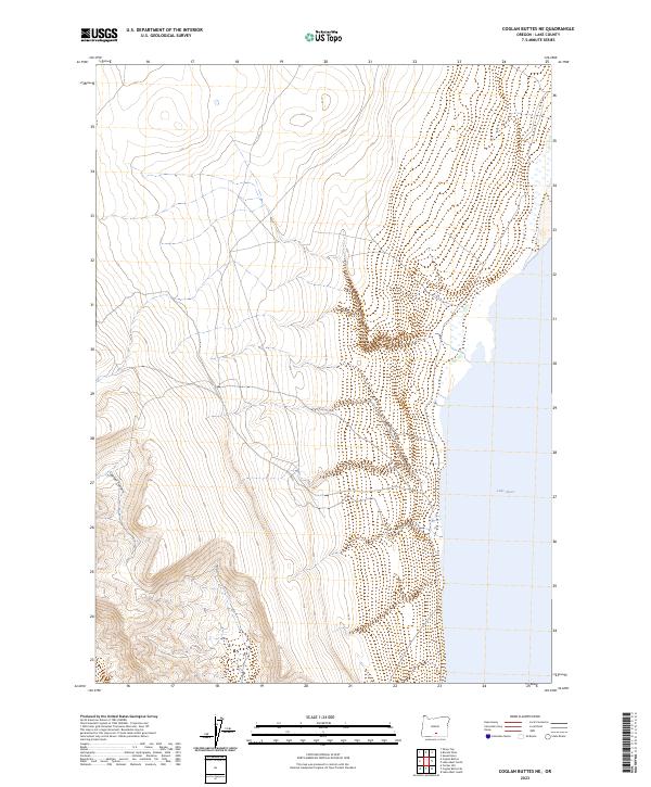
2023 Map of Coglan Buttes NE
USGS Topo · Published 2023About this map
Lake Abert dominates the eastern expanse of this high-desert landscape in Lake County, where the steep fault-block escarpment of the Coglan Buttes meets the shoreline. The terrain is defined by dramatic elevation shifts, notably within Coglan Canyon, which carves through the volcanic uplands. This 2023 survey by the U.S. Geological Survey and BLM captures the stark geography of the Oregon Outback, characterized by its endorheic lake system and precise public land survey system grid lines. The lack of established settlements or road networks within this quadrangle reflects the arid, unsettled nature of this portion of the Great Basin, where land use is primarily managed for conservation and resource oversight.
Find a feature on this map
8 named features on this map. Tap any name to fly to it.
Don’t see what you’re looking for? This feature index may not catch every label — zoom into the map to look around manually.
Map Details
Editions of this 2023 Coglan Buttes NE Map
This is the sole edition of this map. No revisions or reprints were ever made.
Other maps of this area

1955 · Klamath Falls
USGS Topo · 1:250,000

1958 · Klamath Falls
USGS Topo · 1:250,000

1966 · Coglan Buttes NE
USGS Topo · 1:24,000

1966 · Tucker Hill
USGS Topo · 1:24,000

1966 · Coglan Buttes SE
USGS Topo · 1:24,000

1966 · Coglan Buttes
USGS Topo · 1:24,000

1968 · Lake Abert North
USGS Topo · 1:24,000

1968 · Lake Abert South
USGS Topo · 1:24,000

1974 · Lake Abert
USGS Topo · 1:100,000
1984 · Sawed Horn
USGS Topo · 1:24,000