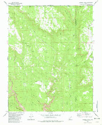
1980 Map of Cogswell Point
USGS Topo · Published 1982About this map
The Zion National Park Boundary cuts across the southwestern corner of this survey, marking the transition from protected parklands to the high-elevation plateaus of the Dixie National Forest area. The landscape is defined by massive topographic features and drainage systems, including the prominent Cogswell Point and the high summit of Miners Peak on the Iron County line. Near the center of the sheet, the distinctive Volcano Knoll rises above Deep Creek, surrounded by remote high-country landmarks like Hogs Heaven and The Plains.
Find a feature on this map
32 named features on this map. Tap any name to fly to it.
Don’t see what you’re looking for? This feature index may not catch every label — zoom into the map to look around manually.
Map Details
Editions of this 1980 Cogswell Point Map
2 editions found

Other maps of this area

1885 · St. George
USGS Topo · 1:250,000

1886 · Kanab
USGS Topo · 1:250,000

1891 · St. George
USGS Topo · 1:250,000

1950 · Cedar City
USGS Topo · 1:62,500

1950 · Cedar Mountain
USGS Topo · 1:24,000

1952 · Cedar Mountain
USGS Topo · 1:24,000

1953 · Cedar City
USGS Topo · 1:250,000

1954 · Orderville Canyon NW
USGS Topo · 1:24,000

1954 · Orderville Canyon SE
USGS Topo · 1:24,000

1957 · Orderville Canyon NE
USGS Topo · 1:24,000