
1954 Map of Orderville Canyon SE
USGS Topo · Published 1956About this map
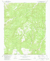
Winders Ranch sits near a local reservoir in this mid-century survey of the high plateau and canyon country of southern Utah. The landscape is defined by the dramatic drainage systems of the North Fork Virgin River and the main Virgin River, where steep elevation changes are documented through intricate contour work. This 1954 mapping effort, published as a preliminary edition, captures a network of isolated water sources and topographical landmarks essential for ranching and navigation in the area. Named canyons and draws, including Orderville Gulch, Willow Canyon, and Jolly Gulch, reveal the erosional patterns of the terrain. The presence of several Stock Tank labels and the isolated Gravel Pit highlight the sparse but specific human utility of this remote stretch of Kane County during the fifties.
Find a feature on this map
16 named features on this map. Tap any name to fly to it.
Don’t see what you’re looking for? This feature index may not catch every label — zoom into the map to look around manually.
Map Details
Editions of this 1954 Orderville Canyon SE Map
This is the sole edition of this map. No revisions or reprints were ever made.
Other maps of this area

1886 · Kanab
USGS Topo · 1:250,000

1953 · Cedar City
USGS Topo · 1:250,000

1954 · Orderville Canyon NW
USGS Topo · 1:24,000

1956 · Springdale NE
USGS Topo · 1:24,000

1957 · Orderville Canyon NE
USGS Topo · 1:24,000

1957 · Kanab
USGS Topo · 1:62,500

1958 · Cedar City
USGS Topo · 1:250,000

1958 · Orderville
USGS Topo · 1:62,500

1962 · Cedar City
USGS Topo · 1:250,000
1980 · Clear Creek Mountain
USGS Topo · 1:24,000