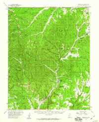
1958 Map of Orderville
USGS Topo · Published 1960About this map
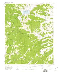
Glendale and Mt Carmel anchor the Virgin River valley in this late-1950s study of Southern Utah's high country. The landscape is defined by the dramatic ascent from the Skutumpah Terrace to the Markagunt Plateau, where the Dixie National Forest covers high-altitude terrain marked by Strawberry Point. Local life centers on the winding river corridor, where the Valley Sch and local Cem served small ranching communities. The map captures a transition in high-desert geography, from the deep incisions of Shingle Mill Canyon and Stout Canyon to the alpine character of McDonald Lake and Le Vanger Lakes. Further north, Long Valley Junction serves as a critical crossroads near Gravel Spr, illustrating the remote but vital transportation network connecting these mountain settlements.
Find a feature on this map
102 named features on this map. Tap any name to fly to it.
Don’t see what you’re looking for? This feature index may not catch every label — zoom into the map to look around manually.
Map Details
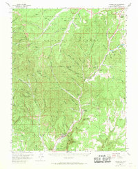
Editions of this 1958 Orderville Map
2 editions found
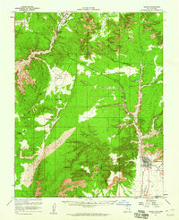
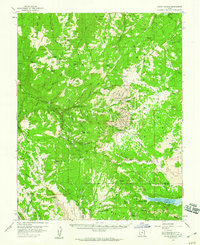
Other maps of this area

1886 · Kanab
USGS Topo · 1:250,000

1953 · Cedar City
USGS Topo · 1:250,000

1954 · Orderville Canyon SE
USGS Topo · 1:24,000

1954 · Johnson
USGS Topo · 1:62,500

1956 · Springdale NE
USGS Topo · 1:24,000

1957 · Orderville Canyon NE
USGS Topo · 1:24,000
1957 · Kanab
USGS Topo · 1:62,500

1958 · Cedar City
USGS Topo · 1:250,000
1958 · Cedar Breaks
USGS Topo · 1:62,500
1958 · Panguitch Lake
USGS Topo · 1:62,500
Featured Places
- Orderville, UT
- Glendale, UT
- Alton, UT
- Long Valley Junction, UT
- Tortoise and Hare Trailer Court, Orderville