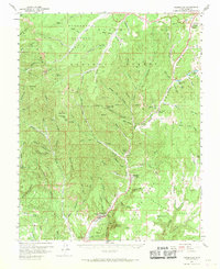
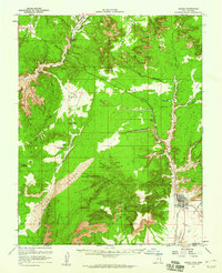
1958 Map of Orderville
USGS Topo · Published 1970About this map
Orderville and the neighboring settlements of Glendale and Mt Carmel anchor the southern reach of the Long Valley in this 1950s survey. The landscape is defined by the East Fork Virgin River, which carves a narrow corridor of human habitation between the high, timbered heights of the Dixie National Forest and the White Cliffs. Local education and community life are marked by the presence of the Valley Sch and a local Cem near the riverbanks. High-elevation landmarks such as Strawberry Point and Pine Knoll overlook a labyrinth of drainage systems including Orderville Gulch and Lydias Canyon. Remote water sources like Hidden Lake and several springs, including Trough Spr and Chokecherry Spr, suggest the vital importance of water management for livestock and homesteading in the Kane County backcountry.
Find a feature on this map
81 named features on this map. Tap any name to fly to it.
Don’t see what you’re looking for? This feature index may not catch every label — zoom into the map to look around manually.
Map Details
Editions of this 1958 Orderville Map
2 editions found
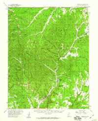
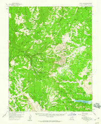
Other maps of this area

1886 · Kanab
USGS Topo · 1:250,000

1953 · Cedar City
USGS Topo · 1:250,000

1954 · Orderville Canyon SE
USGS Topo · 1:24,000

1954 · Johnson
USGS Topo · 1:62,500

1956 · Springdale NE
USGS Topo · 1:24,000

1957 · Orderville Canyon NE
USGS Topo · 1:24,000
1957 · Kanab
USGS Topo · 1:62,500

1958 · Cedar City
USGS Topo · 1:250,000
1958 · Orderville
USGS Topo · 1:62,500
1958 · Cedar Breaks
USGS Topo · 1:62,500
Featured Places
- Orderville, UT
- Glendale, UT
- Alton, UT
- Long Valley Junction, UT
- Tortoise and Hare Trailer Court, Orderville