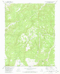
1980 Map of Clear Creek Mountain
USGS Topo · Published 1980About this map
Zion National Park encompasses the southwest corner of this canyon-cut landscape, where the North Fork Virgin River begins to carve through the high plateaus of southern Utah. The terrain is defined by dramatic verticality, from the flat expanse of Table Bench to the depths of Orderville Gulch and East Canyon Creek. This 1980 survey captures the region during a period of active land management and resource exploration, evidenced by scattered Mines and a Gravel Pit near Meadow Creek.
Find a feature on this map
30 named features on this map. Tap any name to fly to it.
Don’t see what you’re looking for? This feature index may not catch every label — zoom into the map to look around manually.
Map Details
Editions of this 1980 Clear Creek Mountain Map
2 editions found
Other maps of this area

1886 · Kanab
USGS Topo · 1:250,000

1953 · Cedar City
USGS Topo · 1:250,000

1954 · Orderville Canyon NW
USGS Topo · 1:24,000

1954 · Orderville Canyon SE
USGS Topo · 1:24,000

1956 · Springdale NE
USGS Topo · 1:24,000

1957 · Orderville Canyon NE
USGS Topo · 1:24,000

1957 · Kanab
USGS Topo · 1:62,500

1958 · Cedar City
USGS Topo · 1:250,000

1958 · Orderville
USGS Topo · 1:62,500

1962 · Cedar City
USGS Topo · 1:250,000