
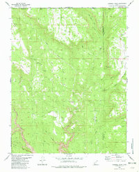
1980 Map of Cogswell Point
USGS Topo · Published 1995About this map
Miners Peak dominates the northern reaches of this high-altitude landscape, where the iron-rich headwaters of Crystal Creek and Big Birch Creek carve deep through the plateau. This 1980 survey captures the rugged topography along the Zion National Park Boundary, revealing a complex network of canyons and gulches like Simon Gulch and Box Canyon. A notable human imprint in this wilderness is the Burnt Flat Landing Strip, located near Cogswell Point, which served as a critical access point for this remote backcountry before many modern roads were established.
Find a feature on this map
33 named features on this map. Tap any name to fly to it.
Don’t see what you’re looking for? This feature index may not catch every label — zoom into the map to look around manually.
Map Details
Editions of this 1980 Cogswell Point Map
2 editions found
Other maps of this area

1885 · St. George
USGS Topo · 1:250,000

1886 · Kanab
USGS Topo · 1:250,000

1891 · St. George
USGS Topo · 1:250,000

1950 · Cedar City
USGS Topo · 1:62,500

1950 · Cedar Mountain
USGS Topo · 1:24,000

1952 · Cedar Mountain
USGS Topo · 1:24,000

1953 · Cedar City
USGS Topo · 1:250,000

1954 · Orderville Canyon NW
USGS Topo · 1:24,000

1954 · Orderville Canyon SE
USGS Topo · 1:24,000

1957 · Orderville Canyon NE
USGS Topo · 1:24,000