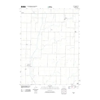
2010 Map of Coin
USGS Topo · Published 2010About this map
The Tarkio River and its numerous tributaries, including East Tarkio Creek and Snake Creek, carve a detailed drainage pattern across this southwestern Iowa landscape. The town of Coin serves as a primary focal point, anchored by the Coin Post Office and the nearby Elmwood Cemetery. This area of Page County is characterized by a grid of rural section roads and small, established communities that reflect the agricultural heritage of the region. Scattered throughout the townships are several family and community burial grounds, such as Posley Cemetery and Snow Hill Cemetery, which offer significant value for genealogical research. The settlement of Yorktown sits in the northeast, maintaining its own identity with the Yorktown Post Office and access to Snake Creek. Smaller locales like Page Center, Norwich, and College Springs on the southern edge further define the late-twentieth-century rural settlement pattern of the Iowa prairie.
Find a feature on this map
31 named features on this map. Tap any name to fly to it.
Don’t see what you’re looking for? This feature index may not catch every label — zoom into the map to look around manually.
Map Details
Editions of this 2010 Coin Map
This is the sole edition of this map. No revisions or reprints were ever made.
Other maps of this area

1939 · Farragut
USGS Topo · 1:62,500

1940 · Farragut
USGS Topo · 1:62,500

1940 · Coin
USGS Topo · 1:62,500

1943 · Coin
USGS Topo · 1:62,500

1955 · Nebraska City
USGS Topo · 1:250,000

1957 · Nebraska City
USGS Topo · 1:250,000

1958 · Nebraska City
USGS Topo · 1:250,000

1978 · Shenandoah East
USGS Topo · 1:24,000

1978 · Stanton SW
USGS Topo · 1:24,000

1978 · Clarinda North
USGS Topo · 1:24,000