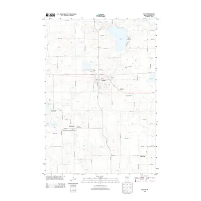
2013 Map of Cokato
USGS Topo · Published 2013About this map
Cokato serves as the central hub of this Wright County landscape, situated along the corridor of Us-12. The surrounding terrain is defined by its glacial history, featuring numerous water bodies like Cokato Lake and Collinwood Lake, alongside the distinct Slough Lakebed. This area retains a strong connection to its Scandinavian heritage, evidenced by the high density of religious and commemorative sites, including the Swedish Cem, Lutheran Cem, and the Stockholm Evangelical Lutheran Church Cem. To the south, the smaller settlement of Stockholm anchors a rural grid of local roads and farmsteads. The agricultural character of the region is punctuated by landmarks such as Countryside Apple Farms and several community gathering points like the Collinwood Regional Park Campground, reflecting a landscape dedicated to both production and recreation amidst the wetlands and creeks.
Find a feature on this map
72 named features on this map. Tap any name to fly to it.
Don’t see what you’re looking for? This feature index may not catch every label — zoom into the map to look around manually.
Map Details
Editions of this 2013 Cokato Map
This is the sole edition of this map. No revisions or reprints were ever made.
Other maps of this area

1953 · New Ulm
USGS Topo · 1:250,000

1953 · Saint Cloud
USGS Topo · 1:250,000

1957 · Saint Cloud
USGS Topo · 1:250,000

1957 · New Ulm
USGS Topo · 1:250,000

1958 · New Ulm
USGS Topo · 1:250,000

1958 · Saint Cloud
USGS Topo · 1:250,000

1958 · Glencoe
USGS Topo · 1:62,500

1958 · Dassel
USGS Topo · 1:62,500

1958 · Cokato
USGS Topo · 1:62,500

1958 · Hutchinson
USGS Topo · 1:62,500
Featured Places
- Cokato, MN
- Stockholm, MN
- Stockholm Township, MN
- Country Village Mobile Estates, Cokato
- Pleasant Terrace Mobile Home Park, Cokato