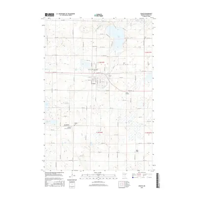
2016 Map of Cokato
USGS Topo · Published 2016About this map
Cokato sits at the center of this Wright County landscape, where the agricultural grid meets a terrain defined by glacial lakes and sloughs. The settlement of Stockholm to the south maintains its identity through a dense concentration of civic and religious sites, notably the Stockholm Evangelical Lutheran Church Cem and the Stockholm Township Cem. The map reveals a high density of burial grounds and small churches scattered across the township lines, including Bethel Cem, Watson Cem, and the Good Shepherd Free Lutheran Church. Water features dictate the local geography, with Cokato Lake and the North Fork Crow River in the north and the expansive Collinwood Lake and Rice Lake in the south. The transition from active water bodies to features like the Slough Lakebed and Dahlgren Slough illustrates the evolving hydrology of this rural Minnesota region.
Find a feature on this map
86 named features on this map. Tap any name to fly to it.
Don’t see what you’re looking for? This feature index may not catch every label — zoom into the map to look around manually.
Map Details
Editions of this 2016 Cokato Map
This is the sole edition of this map. No revisions or reprints were ever made.
Other maps of this area

1953 · New Ulm
USGS Topo · 1:250,000

1953 · Saint Cloud
USGS Topo · 1:250,000

1957 · Saint Cloud
USGS Topo · 1:250,000

1957 · New Ulm
USGS Topo · 1:250,000

1958 · New Ulm
USGS Topo · 1:250,000

1958 · Saint Cloud
USGS Topo · 1:250,000

1958 · Glencoe
USGS Topo · 1:62,500

1958 · Dassel
USGS Topo · 1:62,500

1958 · Cokato
USGS Topo · 1:62,500

1958 · Hutchinson
USGS Topo · 1:62,500
Featured Places
- Cokato, MN
- Stockholm, MN
- Stockholm Township, MN
- Country Village Mobile Estates, Cokato
- Pleasant Terrace Mobile Home Park, Cokato