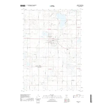
2019 Map of Cokato
USGS Topo · Published 2019About this map
Cokato and the nearby community of Stockholm occupy a landscape defined by glacial activity and a dense network of country roads. The northern edge of the map is dominated by the waters of Cokato Lake, while the North Fork Crow River cuts through the northeast corner. The rural areas between these points are marked by numerous smaller water bodies and depressions, including Dahlgren Slough, Rice Lake, and Grass Lake, which reflect the region's agricultural and hydrologic character.
Find a feature on this map
48 named features on this map. Tap any name to fly to it.
Don’t see what you’re looking for? This feature index may not catch every label — zoom into the map to look around manually.
Map Details
Editions of this 2019 Cokato Map
This is the sole edition of this map. No revisions or reprints were ever made.
Other maps of this area

1953 · New Ulm
USGS Topo · 1:250,000

1953 · Saint Cloud
USGS Topo · 1:250,000

1957 · Saint Cloud
USGS Topo · 1:250,000

1957 · New Ulm
USGS Topo · 1:250,000

1958 · New Ulm
USGS Topo · 1:250,000

1958 · Saint Cloud
USGS Topo · 1:250,000

1958 · Glencoe
USGS Topo · 1:62,500

1958 · Dassel
USGS Topo · 1:62,500

1958 · Cokato
USGS Topo · 1:62,500

1958 · Hutchinson
USGS Topo · 1:62,500
Featured Places
- Cokato, MN
- Stockholm, MN
- Stockholm Township, MN
- Country Village Mobile Estates, Cokato
- Pleasant Terrace Mobile Home Park, Cokato