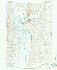
1967 Map of Cokeville
USGS Topo · Published 1971About this map
The town of Cokeville sits at the confluence of the Bear River and Smiths Fork, serving as a vital hub where water, rail, and trail history converge. The Union Pacific railroad parallels the river, underscoring the town's importance as a transportation corridor during the mid-20th century. Highlighting the area's deep pioneer roots, the map traces the Emigrant Trail and the Sublette Cutoff, which skirt the edges of Stoffer Ridge and Sublette Ridge.
Find a feature on this map
48 named features on this map. Tap any name to fly to it.
Don’t see what you’re looking for? This feature index may not catch every label — zoom into the map to look around manually.
Map Details
Editions of this 1967 Cokeville Map
2 editions found
Other maps of this area

1909 · Montpelier
USGS Topo · 1:125,000

1911 · Montpelier
USGS Topo · 1:125,000

1912 · Randolph
USGS Topo · 1:125,000

1936 · Cokeville
USGS Topo · 1:96,000

1942 · Cokeville
USGS Topo · 1:125,000

1954 · Sage
USGS Topo · 1:62,500

1954 · Ogden
USGS Topo · 1:250,000

1955 · Preston
USGS Topo · 1:250,000

1958 · Ogden
USGS Topo · 1:250,000

1958 · Preston
USGS Topo · 1:250,000