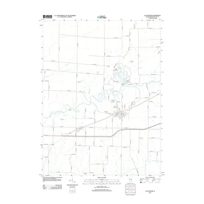
2012 Map of Colchester
USGS Topo · Published 2012About this map
Colchester serves as the primary hub of this McDonough County landscape, centered on a grid of streets including W Depot St and W Market St. The surrounding countryside is defined by the winding course of the E Fork La Moine River and its tributaries, such as Cedar Cr and Troublesome Cr. To the north, the terrain transitions into the carved landscape of Argyle Hollow, where Argyle Lake provides a central focal point for recreation at Campers Hill Campground and University Point Campground.
Find a feature on this map
55 named features on this map. Tap any name to fly to it.
Don’t see what you’re looking for? This feature index may not catch every label — zoom into the map to look around manually.
Map Details
Editions of this 2012 Colchester Map
This is the sole edition of this map. No revisions or reprints were ever made.
Other maps of this area

1912 · Macomb
USGS Topo · 1:62,500

1913 · Colchester
USGS Topo · 1:62,500

1914 · Macomb
USGS Topo · 1:62,500

1916 · Good Hope
USGS Topo · 1:62,500

1918 · La Harpe
USGS Topo · 1:62,500

1918 · Good Hope
USGS Topo · 1:62,500

1958 · Burlington
USGS Topo · 1:250,000

1961 · Burlington
USGS Topo · 1:250,000

1963 · Burlington
USGS Topo · 1:250,000
1974 · Doddsville
USGS Topo · 1:24,000