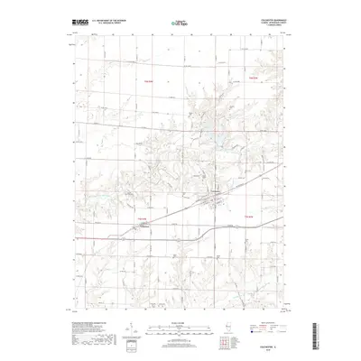
2018 Map of Colchester
USGS Topo · Published 2018About this map
The East Fork La Moine River meanders across this McDonough County landscape, anchoring a region defined by its dispersed rural cemeteries and the small settlements of Colchester and Tennessee. Genealogists will find an unusually dense record of burial sites, including Sacred Heart Cem, Mount Auburn Cem, and Argyle Cem, which reflect the long-standing family and community ties in the area. The local topography is further shaped by Argyle Lake and Irish Lake, while a network of county roads like CO Hwy 8 and Telegraph Rd connect the isolated farmsteads. The settlement of Colchester serves as the primary hub, with its grid of streets including Macomb St and W Jackson St providing a glimpse into the town's residential and commercial core during the late 2010s.
Find a feature on this map
59 named features on this map. Tap any name to fly to it.
Don’t see what you’re looking for? This feature index may not catch every label — zoom into the map to look around manually.
Map Details
Editions of this 2018 Colchester Map
This is the sole edition of this map. No revisions or reprints were ever made.
Other maps of this area

1912 · Macomb
USGS Topo · 1:62,500

1913 · Colchester
USGS Topo · 1:62,500

1914 · Macomb
USGS Topo · 1:62,500

1916 · Good Hope
USGS Topo · 1:62,500

1918 · La Harpe
USGS Topo · 1:62,500

1918 · Good Hope
USGS Topo · 1:62,500

1958 · Burlington
USGS Topo · 1:250,000

1961 · Burlington
USGS Topo · 1:250,000

1963 · Burlington
USGS Topo · 1:250,000
1974 · Doddsville
USGS Topo · 1:24,000