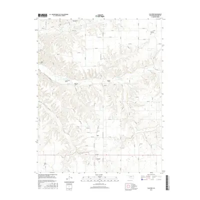
2016 Map of Colcord
USGS Topo · Published 2016About this map
The town of Colcord and the nearby settlement of Row anchor this 2016 study of Delaware County, Oklahoma. The landscape is defined by the winding course of Spavinaw Cr and its tributaries, including Cherokee Cr and Hog Eye Cr, which have carved numerous deep ravines and named topographic features such as Beamer Hollow and Crazy Nance Hollow. The prevalence of family-named burial grounds like Thompson-Edmondson Cem, O'Field Cem, and Beck Cem suggests a deeply rooted local genealogy and a history of rural landholdings across the timbered ridges. To the north, the small community of Sycamore sits near the headwaters of Beaty Cr, illustrating the persistent small-town structure of this corner of the state. The map reveals how the modern road network, including Watertower Rd and Oak Hill Rd, follows the high ground between these drainage basins.
Find a feature on this map
96 named features on this map. Tap any name to fly to it.
Don’t see what you’re looking for? This feature index may not catch every label — zoom into the map to look around manually.
Map Details
Editions of this 2016 Colcord Map
This is the sole edition of this map. No revisions or reprints were ever made.
Other maps of this area

1899 · Siloam Springs
USGS Topo · 1:125,000

1903 · Siloam Springs
USGS Topo · 1:125,000

1904 · Siloam Springs
USGS Topo · 1:125,000

1954 · Tulsa
USGS Topo · 1:250,000

1958 · Tulsa
USGS Topo · 1:250,000

1963 · Tulsa
USGS Topo · 1:250,000

1971 · Jay SE
USGS Topo · 1:24,000
1971 · Jay
USGS Topo · 1:24,000
1971 · Sycamore
USGS Topo · 1:24,000
1971 · Cherokee City
USGS Topo · 1:24,000