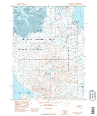
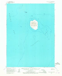
1995 Map of Cold Bay A-3
USGS Topo · Published 1995About this map
Cold Bay serves as the primary outpost on this mid-1990s survey of the western Alaska Peninsula. The landscape is dominated by the sprawling Izembek National Wildlife Refuge and the designated Izembek Wilderness, where the coastal environment transitions from the tidal flats of Izembek Lagoon to the high reaches of Frosty Peak Glacier. Commercial and technical infrastructure of the era is evidenced by a quarry, a series of tanks, and the Satellite Triang Station 125 near the coast. Water features are abundant across the tundra, including Rescue Lake, Blue Bill Lake, and Simeon Lake, while the southern coastline is defined by Littlejohn Lagoon and Morzhovoi Bay. This map documents a critical maritime and ecological crossroads where the Bering Sea meets the North Pacific via the peninsula's narrow land bridge.
Find a feature on this map
34 named features on this map. Tap any name to fly to it.
Don’t see what you’re looking for? This feature index may not catch every label — zoom into the map to look around manually.
Map Details
Editions of this 1995 Cold Bay A-3 Map
This is the sole edition of this map. No revisions or reprints were ever made.
Other maps of this area

1943 · Fort Randall
USGS Topo · 1:250,000
1944 · Cold Bay Sheet No. 20 of 25
USGS Topo · 1:25,000

1949 · False Pass
USGS Topo · 1:250,000

1949 · Fort Randall
USGS Topo · 1:250,000

1950 · False Pass
USGS Topo · 1:250,000

1950 · Fort Randall
USGS Topo · 1:250,000
1963 · False Pass D-3
USGS Topo · 1:63,360
1963 · Cold Bay B-3
USGS Topo · 1:63,360

1963 · False Pass D-2
USGS Topo · 1:63,360
1963 · Cold Bay B-4
USGS Topo · 1:63,360