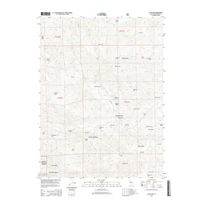
2015 Map of Cold Fork
USGS Topo · Published 2015About this map
Skinner Mill Place and several other family-named sites anchor this portion of the northern California landscape, where the foothills of the Trinity National Forest meet the drainage systems of Tehama County. The terrain is defined by a dense network of gulches and flats, many bearing names that suggest early homesteading and resource use, such as Schoolhouse Flat, Woodyard Flat, and Shakecabin Flat. Water sources are vital features in this environment, with S Fork Cottonwood Cr and the Cold Fork providing the primary drainage for the area's numerous springs, including Halley Spring and Sulphur Spring. These features, alongside peaks like Stevenson Peak and Salt Creek Peak, illustrate a geography where small-scale settlement patterns were dictated by the availability of water and the orientation of the ridges and canyons.
Find a feature on this map
61 named features on this map. Tap any name to fly to it.
Don’t see what you’re looking for? This feature index may not catch every label — zoom into the map to look around manually.
Map Details
Editions of this 2015 Cold Fork Map
This is the sole edition of this map. No revisions or reprints were ever made.
Other maps of this area

1890 · Red Bluff
USGS Topo · 1:250,000

1894 · Red Bluff
USGS Topo · 1:250,000

1949 · Colyear Springs
USGS Topo · 1:62,500

1951 · Chanchelulla Peak
USGS Topo · 1:62,500

1952 · Ono
USGS Topo · 1:62,500

1954 · Yolla Bolly
USGS Topo · 1:62,500

1957 · Colyear Springs
USGS Topo · 1:62,500

1958 · Redding
USGS Topo · 1:250,000
1967 · Cold Fork
USGS Topo · 1:24,000
1967 · Oxbow Bridge
USGS Topo · 1:24,000