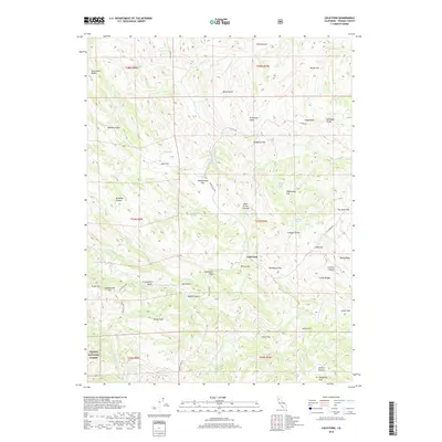
2018 Map of Cold Fork
USGS Topo · Published 2018About this map
The Cold Fork settlement sits at the heart of this landscape, where numerous gulches and flats define the drainages leading toward the S Fork Cottonwood Cr. Named for its position relative to the local hydrology, the area is marked by historic points of interest like Schoolhouse Flat and Shakecabin Flat, suggesting early ranching or communal structures in this part of Tehama County. The terrain is characterized by high points such as Stevenson Peak and Salt Creek Peak, with unique local landmarks like Hole in the Ground and Salt Lick punctuating the mountain slopes.
Find a feature on this map
56 named features on this map. Tap any name to fly to it.
Don’t see what you’re looking for? This feature index may not catch every label — zoom into the map to look around manually.
Map Details
Editions of this 2018 Cold Fork Map
This is the sole edition of this map. No revisions or reprints were ever made.
Other maps of this area

1890 · Red Bluff
USGS Topo · 1:250,000

1894 · Red Bluff
USGS Topo · 1:250,000

1949 · Colyear Springs
USGS Topo · 1:62,500

1951 · Chanchelulla Peak
USGS Topo · 1:62,500

1952 · Ono
USGS Topo · 1:62,500

1954 · Yolla Bolly
USGS Topo · 1:62,500

1957 · Colyear Springs
USGS Topo · 1:62,500

1958 · Redding
USGS Topo · 1:250,000
1967 · Cold Fork
USGS Topo · 1:24,000
1967 · Oxbow Bridge
USGS Topo · 1:24,000