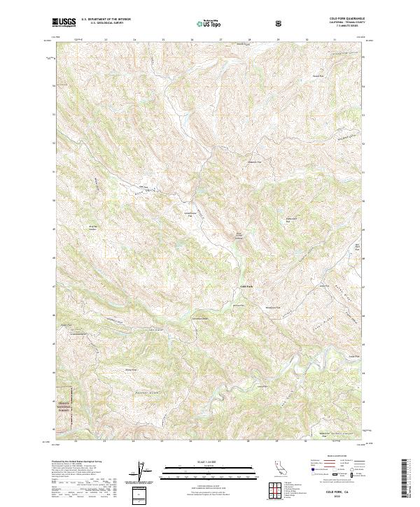
2022 Map of Cold Fork
USGS Topo · Published 2022About this map
Cold Fork anchors this corner of Tehama County, where the eastern edges of the Trinity National Forest meet a landscape of flats, peaks, and seasonal drainages. The area is defined by its numerous topographic "flats" which hint at past uses or localized landmarks, such as Schoolhouse Flat, Shakecabin Flat, and Woodyard Flat. These names, alongside features like Poker Flat, suggest a history of early settlement and resource extraction in the foothills.
Find a feature on this map
59 named features on this map. Tap any name to fly to it.
Don’t see what you’re looking for? This feature index may not catch every label — zoom into the map to look around manually.
Map Details
Editions of this 2022 Cold Fork Map
This is the sole edition of this map. No revisions or reprints were ever made.
Other maps of this area

1890 · Red Bluff
USGS Topo · 1:250,000

1894 · Red Bluff
USGS Topo · 1:250,000

1949 · Colyear Springs
USGS Topo · 1:62,500

1951 · Chanchelulla Peak
USGS Topo · 1:62,500

1952 · Ono
USGS Topo · 1:62,500

1954 · Yolla Bolly
USGS Topo · 1:62,500

1957 · Colyear Springs
USGS Topo · 1:62,500

1958 · Redding
USGS Topo · 1:250,000
1967 · Cold Fork
USGS Topo · 1:24,000
1967 · Oxbow Bridge
USGS Topo · 1:24,000