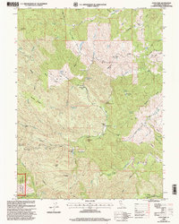
1998 Map of Cold Fork
USGS Topo · Published 2003About this map
Cold Fork sits at the center of this 1990s revision, marking a landscape defined by ranching homesteads and mountain flats within the Shasta Trinity National Forests. The map reveals a deeply etched topography of gulches and glades, where family-named landmarks like Pettyjohn Place and Alford Place indicate long-standing habitation in these western reaches of Tehama County. The terrain transitions from the high elevations of Stevenson Peak and Salt Creek Peak down to the creek beds of Salt Creek and the South Fork Cottonwood Creek.
Find a feature on this map
72 named features on this map. Tap any name to fly to it.
Don’t see what you’re looking for? This feature index may not catch every label — zoom into the map to look around manually.
Map Details
Editions of this 1998 Cold Fork Map
This is the sole edition of this map. No revisions or reprints were ever made.
Other maps of this area

1890 · Red Bluff
USGS Topo · 1:250,000

1894 · Red Bluff
USGS Topo · 1:250,000

1949 · Colyear Springs
USGS Topo · 1:62,500

1951 · Chanchelulla Peak
USGS Topo · 1:62,500

1952 · Ono
USGS Topo · 1:62,500

1954 · Yolla Bolly
USGS Topo · 1:62,500

1957 · Colyear Springs
USGS Topo · 1:62,500

1958 · Redding
USGS Topo · 1:250,000
1967 · Cold Fork
USGS Topo · 1:24,000
1967 · Oxbow Bridge
USGS Topo · 1:24,000