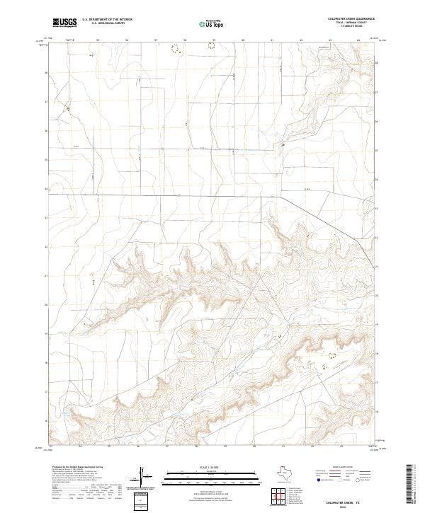
2022 Map of Coldwater Creek
USGS Topo · Published 2022About this map
Coldwater Cr carves a significant drainage through the high plains of Sherman County, revealing a landscape defined by sharp topographic relief in an otherwise flat agricultural region. The creek bed and its surrounding breaks dominate the southern and eastern portions of the map, contrasting with the rigid grid of county roads that organize the upland sections. Near the southwestern edge of the drainage system, Coldwater Springs emerges as a critical hydrological feature in this arid environment. The road network, including Co Rd L and Co Rd 26, follows the section lines characteristic of the Texas Panhandle's land system, providing access to the vast open tracts between the deeply incised valleys of the Coldwater watershed.
Find a feature on this map
9 named features on this map. Tap any name to fly to it.
Don’t see what you’re looking for? This feature index may not catch every label — zoom into the map to look around manually.
Map Details
Editions of this 2022 Coldwater Creek Map
This is the sole edition of this map. No revisions or reprints were ever made.
Other maps of this area

1954 · Perryton
USGS Topo · 1:250,000

1958 · Perryton
USGS Topo · 1:250,000

1974 · Sunray 1 NW
USGS Topo · 1:24,000

1974 · Texhoma South
USGS Topo · 1:24,000

1974 · Stevens SE
USGS Topo · 1:24,000

1974 · Sunray 1 SW
USGS Topo · 1:24,000

1974 · Sunray 1 SE
USGS Topo · 1:24,000

1974 · Capps Switch NW
USGS Topo · 1:24,000
1974 · Pleasure Pond
USGS Topo · 1:24,000

1974 · Hannas Draw West
USGS Topo · 1:24,000