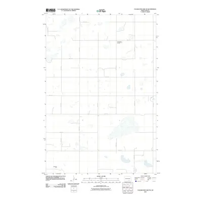
2011 Map of Coldwater Lake NE
USGS Topo · Published 2011About this map
Granadenfeld Congregational Cemetery stands as a solitary landmark in this section of Dickey County, reflecting the deep-rooted heritage of the Congregationalist communities that settled the North Dakota prairie. The landscape is defined by a grid-like network of rural section roads, including 81st St SE and 60th Ave SE, which organize the agricultural terrain and small seasonal wetlands. Water management is evident near the southern boundary at the Schlenker Dam, which regulates local drainage in this prairie pothole region. This map provides a clear view of the rural infrastructure at the start of the twenty-first century, preserving the exact coordinates of family burial grounds and small-scale water works that remain vital to local genealogy and land use history.
Find a feature on this map
17 named features on this map. Tap any name to fly to it.
Don’t see what you’re looking for? This feature index may not catch every label — zoom into the map to look around manually.
Map Details
Editions of this 2011 Coldwater Lake NE Map
This is the sole edition of this map. No revisions or reprints were ever made.
Other maps of this area

1896 · Edgeley
USGS Topo · 1:125,000

1925 · Edgeley
USGS Topo · 1:125,000

1953 · Jamestown
USGS Topo · 1:250,000

1956 · Jamestown
USGS Topo · 1:250,000

1971 · Merricourt NW
USGS Topo · 1:24,000
1971 · Merricourt SW
USGS Topo · 1:24,000

1982 · Coldwater Lake NW
USGS Topo · 1:24,000

1982 · Guyson
USGS Topo · 1:24,000

1982 · Coldwater Lake NE
USGS Topo · 1:24,000

1982 · Fredonia
USGS Topo · 1:24,000