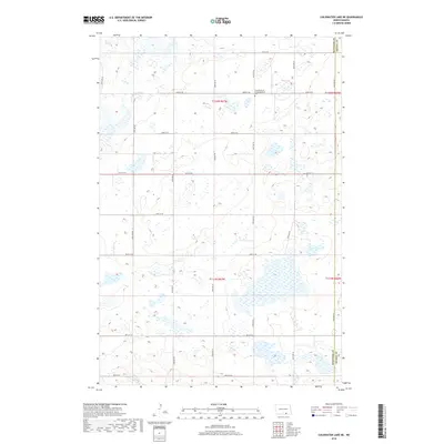
2018 Map of Coldwater Lake NE
USGS Topo · Published 2018About this map
The Gnadenfeld Congregational Cem serves as a significant cultural landmark in this landscape along the border of Mcintosh County and Dickey County. This 2018 survey illustrates a rural environment defined by the Public Land Survey System, where a precise grid of gravel and section roads like 82nd St SE and 64th Ave SE divides the prairie into established townships, including t132n r67w and t131n r67w. The terrain is characterized by numerous small potholes and wetlands typical of the Missouri Coteau region, reflecting a landscape where water naturally collects in depressions among the low rises. These features, coupled with the isolated cemetery, highlight the long-standing agricultural and community patterns of the North Dakota plains.
Find a feature on this map
21 named features on this map. Tap any name to fly to it.
Don’t see what you’re looking for? This feature index may not catch every label — zoom into the map to look around manually.
Map Details
Editions of this 2018 Coldwater Lake NE Map
This is the sole edition of this map. No revisions or reprints were ever made.
Other maps of this area

1896 · Edgeley
USGS Topo · 1:125,000

1925 · Edgeley
USGS Topo · 1:125,000

1953 · Jamestown
USGS Topo · 1:250,000

1956 · Jamestown
USGS Topo · 1:250,000

1971 · Merricourt NW
USGS Topo · 1:24,000
1971 · Merricourt SW
USGS Topo · 1:24,000

1982 · Coldwater Lake NW
USGS Topo · 1:24,000

1982 · Guyson
USGS Topo · 1:24,000

1982 · Coldwater Lake NE
USGS Topo · 1:24,000

1982 · Fredonia
USGS Topo · 1:24,000