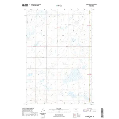
2020 Map of Coldwater Lake NE
USGS Topo · Published 2020About this map
The boundary line between McIntosh Co and Dickey Co bisects this remote portion of North Dakota, where the landscape is defined by an expansive network of wetlands and potholes. A significant point of local interest is the Granadenfeld Congregational Cem, a lone marker of community history positioned along 82nd St SE near the county line. The grid of section roads, including 64th Ave SE and 86th St SE, underscores the systematic land division that shapes the agricultural layout of Northwest Township. This survey provides a precise look at the prairie topography as it appeared in the early 21st century, detailing the drainage patterns and small water bodies that characterize this part of the state.
Find a feature on this map
21 named features on this map. Tap any name to fly to it.
Don’t see what you’re looking for? This feature index may not catch every label — zoom into the map to look around manually.
Map Details
Editions of this 2020 Coldwater Lake NE Map
This is the sole edition of this map. No revisions or reprints were ever made.
Other maps of this area

1896 · Edgeley
USGS Topo · 1:125,000

1925 · Edgeley
USGS Topo · 1:125,000

1953 · Jamestown
USGS Topo · 1:250,000

1956 · Jamestown
USGS Topo · 1:250,000

1971 · Merricourt NW
USGS Topo · 1:24,000
1971 · Merricourt SW
USGS Topo · 1:24,000

1982 · Coldwater Lake NW
USGS Topo · 1:24,000

1982 · Guyson
USGS Topo · 1:24,000

1982 · Coldwater Lake NE
USGS Topo · 1:24,000

1982 · Fredonia
USGS Topo · 1:24,000