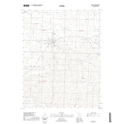
2017 Map of Cole Camp
USGS Topo · Published 2017About this map
Cole Camp serves as the central hub of this Benton County landscape, where the street grid meets several prominent regional routes. The area is notable for its high density of family and denominational burial grounds, including the Cole Camp Memorial Cem, Saints Peter and Paul Cem, and Saint Johns Lutheran Cem. These sites, along with smaller plots like Eickhoff Cem and Monsees Cem, point to a deeply rooted community with well-established ancestral ties. Beyond the main settlement, the terrain is defined by a network of creeks and branches, such as Cole Camp Cr and Otten Br, which drain the undulating countryside toward the east. The small community of Crest sits near the eastern edge, while the western reaches feature B B Rekus Lake and the Union Williams Cem along Seven Hills Rd.
Find a feature on this map
81 named features on this map. Tap any name to fly to it.
Don’t see what you’re looking for? This feature index may not catch every label — zoom into the map to look around manually.
Map Details
Editions of this 2017 Cole Camp Map
This is the sole edition of this map. No revisions or reprints were ever made.
Other maps of this area

1887 · Sedalia
USGS Topo · 1:125,000

1887 · Warsaw
USGS Topo · 1:125,000

1894 · Warsaw
USGS Topo · 1:125,000

1894 · Sedalia
USGS Topo · 1:125,000

1935 · Boylers Mill
USGS Topo · 1:24,000

1936 · Lakeview Heights
USGS Topo · 1:24,000

1936 · Schuyler
USGS Topo · 1:24,000

1947 · Jefferson City
USGS Topo · 1:250,000
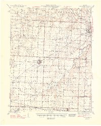
1948 · Green Ridge
USGS Topo · 1:62,500

1954 · Jefferson City
USGS Topo · 1:250,000