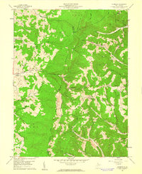
1959 Map of Colebank
USGS Topo · Published 1961About this map
Laurel Mountain and Reno Mountain dominate this mid-century portrait of a highland landscape where the borders of Barbour, Preston, and Tucker Counties converge. The settlement pattern is defined by small, dispersed communities like Colebank and Valley Furnace, each linked by a network of winding mountain roads and trails. This area, largely encompassed by the Monongahela National Forest, shows a rural economy centered on the ridges and hollows, evidenced by the numerous small country schools such as Digman Sch and Pifer Sch, and churches like Shiloh Ch. Drainage follows a complex system of forks, including Licking Creek and Sandy Creek, which carve deep valleys through the heavily wooded terrain. The presence of several Gas Well sites and a prominent pipeline cutting across the slopes indicates the industrial activity that sustained these remote West Virginia communities during the late 1950s.
Find a feature on this map
50 named features on this map. Tap any name to fly to it.
Don’t see what you’re looking for? This feature index may not catch every label — zoom into the map to look around manually.
Map Details
Editions of this 1959 Colebank Map
4 editions found
Other maps of this area

1886 · St. George
USGS Topo · 1:125,000

1891 · St. George
USGS Topo · 1:125,000

1907 · Thornton
USGS Topo · 1:62,500

1907 · Kingwood
USGS Topo · 1:62,500

1907 · Belington
USGS Topo · 1:62,500

1908 · Parsons
USGS Topo · 1:62,500

1925 · Kingwood
USGS Topo · 1:62,500

1926 · Thornton
USGS Topo · 1:62,500

1926 · Parsons
USGS Topo · 1:62,500

1927 · Belington
USGS Topo · 1:62,500