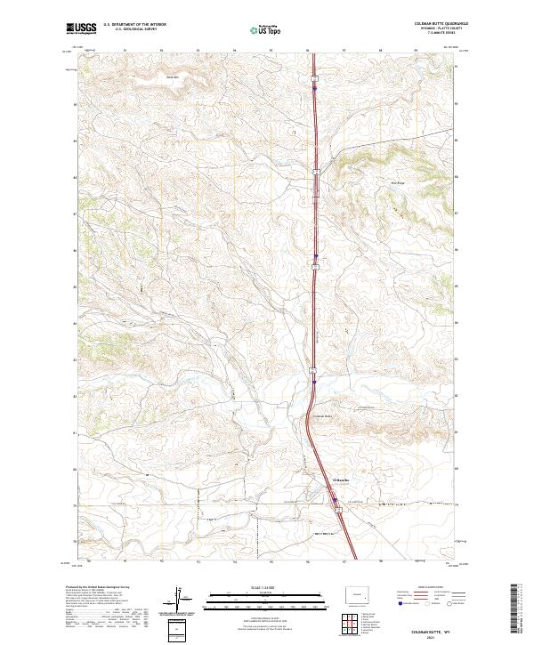
2021 Map of Coleman Butte
USGS Topo · Published 2021About this map
El Rancho sits at the heart of this high plains landscape, situated where the modern corridor of the Frontage Rd and Interstate 25 intersects historical rural thoroughfares like E El Rancho Rd and Pepper Rd. The terrain is defined by a series of prominent elevations, most notably the namesake Coleman Butte, along with Table Mtn and the eastern stretch of Pine Ridge. These landmarks overlook a complex drainage system where South Bear Creek and Crow Creek cut through the topography.
Find a feature on this map
25 named features on this map. Tap any name to fly to it.
Don’t see what you’re looking for? This feature index may not catch every label — zoom into the map to look around manually.
Map Details
Editions of this 2021 Coleman Butte Map
This is the sole edition of this map. No revisions or reprints were ever made.
Other maps of this area

1896 · Hartville
USGS Topo · 1:125,000

1901 · Hartville
USGS Topo · 1:125,000

1949 · Spring Creek
USGS Topo · 1:24,000

1950 · Spring Creek
USGS Topo · 1:24,000

1950 · Coleman Butte
USGS Topo · 1:24,000

1950 · Herman Ranch
USGS Topo · 1:24,000

1950 · Cottonwood Falls
USGS Topo · 1:24,000

1951 · Coleman Butte
USGS Topo · 1:24,000

1951 · Sibley Peak
USGS Topo · 1:24,000

1951 · Cottonwood Falls
USGS Topo · 1:24,000