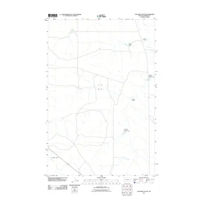
2011 Map of Coleman Coulee
USGS Topo · Published 2011About this map
Coleman Coulee characterizes this remote reach of Garfield County, Montana, where a network of ephemeral drainages and coulees carve through the high plains landscape. This 2011 survey reveals a territory where water management is critical for land use, evidenced by a series of small-scale reservoirs and embankments. To the north, the Taylor Number 2 Dam sits near Uall Creek, while further south, the Glasscock Reservoir Number 1 Dam and Glasscock Reservoir Number 2 Dam highlight the specific ranching or irrigation infrastructure of the region. The map also documents the rugged path of Eckman Coulee and the crossing of Uall Rd, which serves as one of the few named transportation arteries in this expansive, sparsely populated section of the Montana interior.
Find a feature on this map
9 named features on this map. Tap any name to fly to it.
Don’t see what you’re looking for? This feature index may not catch every label — zoom into the map to look around manually.
Map Details
Editions of this 2011 Coleman Coulee Map
This is the sole edition of this map. No revisions or reprints were ever made.
Other maps of this area

1954 · Jordan
USGS Topo · 1:250,000

1954 · Forsyth
USGS Topo · 1:250,000

1956 · Jordan
USGS Topo · 1:250,000

1957 · Forsyth
USGS Topo · 1:250,000

1958 · Jordan
USGS Topo · 1:250,000

1958 · Forsyth
USGS Topo · 1:250,000

1964 · Jordan
USGS Topo · 1:250,000

1965 · Rock Springs School
USGS Topo · 1:24,000

1965 · Little Chalk Butte
USGS Topo · 1:24,000

1965 · Clear Water Reservoir
USGS Topo · 1:24,000