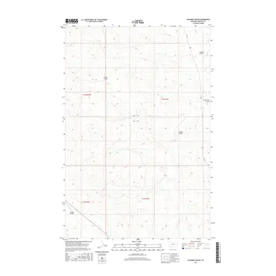
2017 Map of Coleman Coulee
USGS Topo · Published 2017About this map
Sleepy Hollow defines the central terrain of this Garfield County landscape, where the high plains are carved by an intricate network of drainage systems. The map detail reflects the classic homesteading grid of the American West, organized into sections and townships such as t14n r43e and t13n r42e. Named drainages provide the primary landmarks for this sparsely settled region, including the curiously named Frozen Dog Coulee in the northeast and Eckman Coulee toward the center.
Find a feature on this map
12 named features on this map. Tap any name to fly to it.
Don’t see what you’re looking for? This feature index may not catch every label — zoom into the map to look around manually.
Map Details
Editions of this 2017 Coleman Coulee Map
This is the sole edition of this map. No revisions or reprints were ever made.
Other maps of this area

1954 · Jordan
USGS Topo · 1:250,000

1954 · Forsyth
USGS Topo · 1:250,000

1956 · Jordan
USGS Topo · 1:250,000

1957 · Forsyth
USGS Topo · 1:250,000

1958 · Jordan
USGS Topo · 1:250,000

1958 · Forsyth
USGS Topo · 1:250,000

1964 · Jordan
USGS Topo · 1:250,000

1965 · Rock Springs School
USGS Topo · 1:24,000

1965 · Little Chalk Butte
USGS Topo · 1:24,000

1965 · Clear Water Reservoir
USGS Topo · 1:24,000