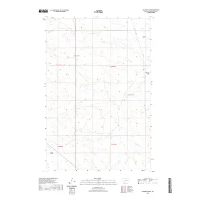
2020 Map of Coleman Coulee
USGS Topo · Published 2020About this map
Sleepy Hollow sits among the high plains and erosion-carved drainages of Garfield County in this 2020 topographic record. The landscape is defined by its dramatic coulees, with Coleman Coulee and Frozen Dog Coulee cutting deep into the northern terrain near Uall Cr. This portion of Montana's ranching country remains sparsely developed, with the path of Uall Rd providing the primary corridor through the eastern sections. The township and range lines of T14N and T13N grid the territory, where water management is marked by the presence of Red Butte Cr in the southwest and Eckman Coulee in the central reaches. These drainage patterns, including the notable Douglas Coulee, illustrate the hydraulic forces that have shaped the Missouri River watershed over millennia.
Find a feature on this map
12 named features on this map. Tap any name to fly to it.
Don’t see what you’re looking for? This feature index may not catch every label — zoom into the map to look around manually.
Map Details
Editions of this 2020 Coleman Coulee Map
This is the sole edition of this map. No revisions or reprints were ever made.
Other maps of this area

1954 · Jordan
USGS Topo · 1:250,000

1954 · Forsyth
USGS Topo · 1:250,000

1956 · Jordan
USGS Topo · 1:250,000

1957 · Forsyth
USGS Topo · 1:250,000

1958 · Jordan
USGS Topo · 1:250,000

1958 · Forsyth
USGS Topo · 1:250,000

1964 · Jordan
USGS Topo · 1:250,000

1965 · Rock Springs School
USGS Topo · 1:24,000

1965 · Little Chalk Butte
USGS Topo · 1:24,000

1965 · Clear Water Reservoir
USGS Topo · 1:24,000